I’ll preface this with saying this was not my favorite stretch of trail. I’m almost convinced it’s some sort of sadistic attempt to connect and traverse as many burns as possible. The sad reality is that there are vast areas of Oregon that are fire scorched, and many are added every year.
Day 1
I started with a 4-hour drive after work on Friday to get to the McKenzie Pass trailhead. One of the benefits of working an EST timezone job and living temporarily in PST is being done with work before 2pm everyday. The flipside is the 5am meetings and lack of sleep, but it’s only temporary, and the reward is worth it.
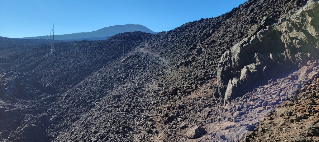
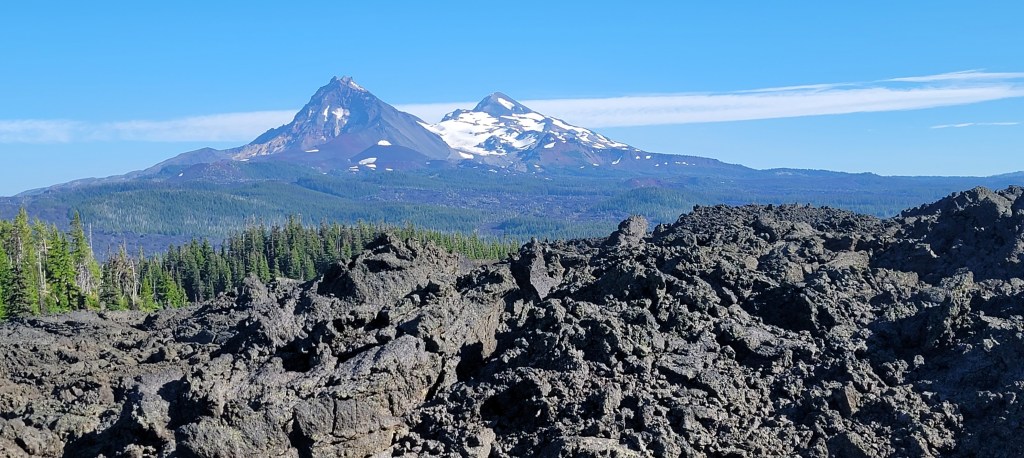
I park in the middle of lava fields and immediately start climbing into what may as well be Mordor. I don’t think I’ve ever crossed this much lava and am grateful it’s evening and breezy. The barrenness of my immediate surroundings is balanced by impressive views of the Three Sisters range to the southeast and Mt. Washington to the north. I cross into living trees a couple miles later and then quickly enter a burn. A few miles later, I pass back into living trees and cover a few more miles before calling it a night.

Day 2
I wake early, which, if you’ve noticed, is a trend for me. The period from 1st light to sunrise is my absolute favorite time to hike. Trails are still empty, the world is quiet, and I thrive on the challenge of knocking out miles early, often shooting for 9 by 9 and 20 by noon. My plan is to put in at least 30 miles today so I can finish by noon tomorrow for logistical reasons. Angela will meet me at the end, and we then have to drive 3hrs to where I parked and then 4hrs back to Portland.
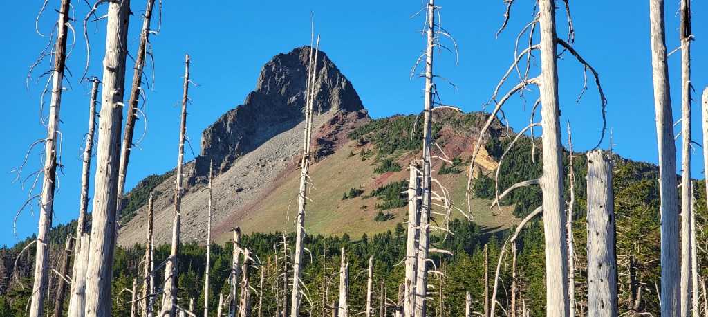
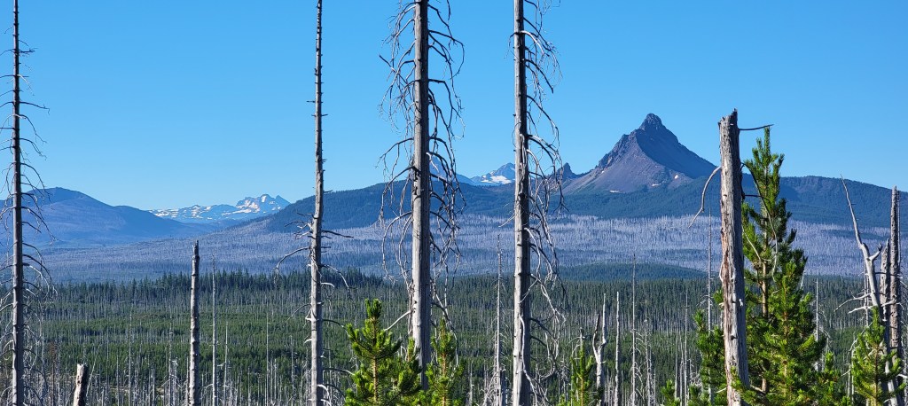
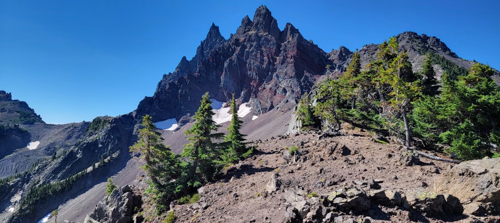
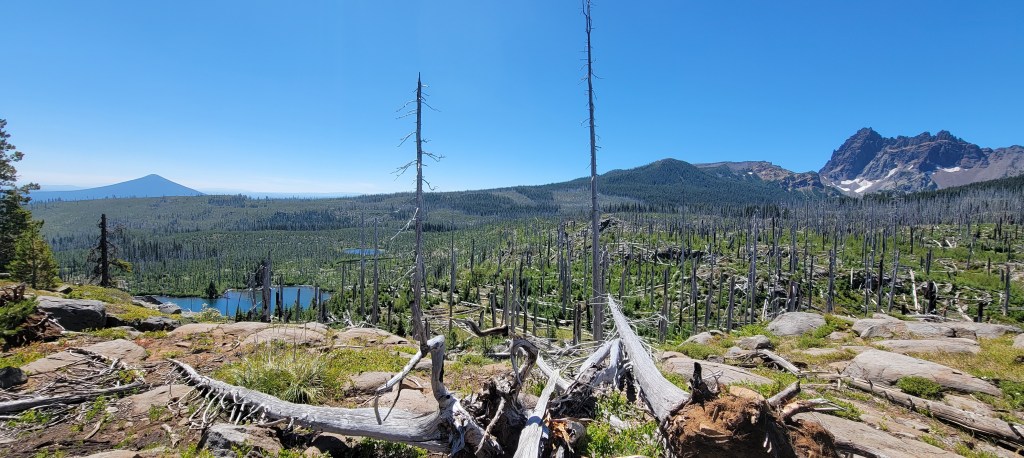
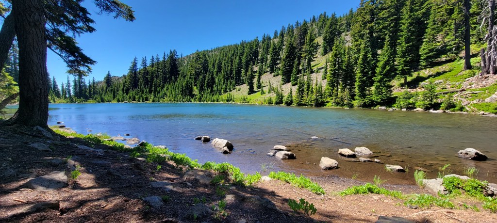
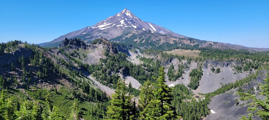
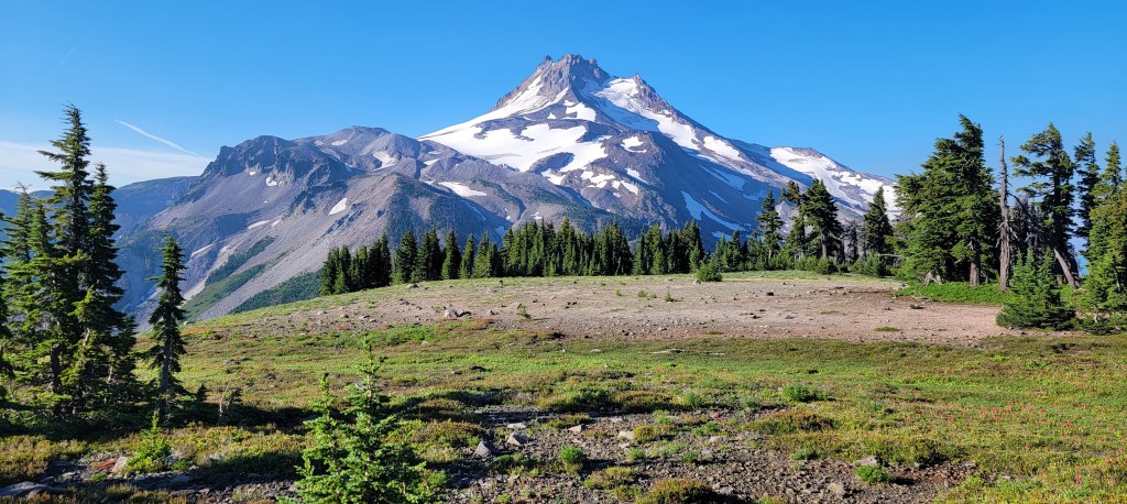
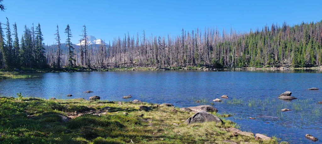
The hike enters a burn almost immediately, and then goes back to live trees, and then back to a burn at Santiam Pass, where the trail begins to climb. The trail is well maintained, and the climb goes by quickly as I skirt the western flanks of Three Fingered Jack. Somewhere after that, it feels like I’m progressing through burn after burn with abundant blowdowns. Most are in burns, but many are large green trees that have come down outside of the burn zone. My pace slows as I cross what was probably a couple hundred blowdowns and lose the trail briefly a few times while doing so. I eventually get back to clear trail in time to take a break to wade in a lake and cool off. The rest of the hike is wooded and mostly downhill to camp but has some spectacular views of Mt. Jefferson along the way. I end up covering over 35 miles, leaving me another 18 miles to go tomorrow.


Day 3
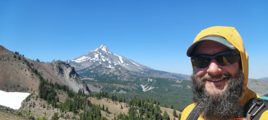
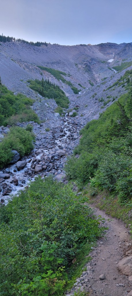
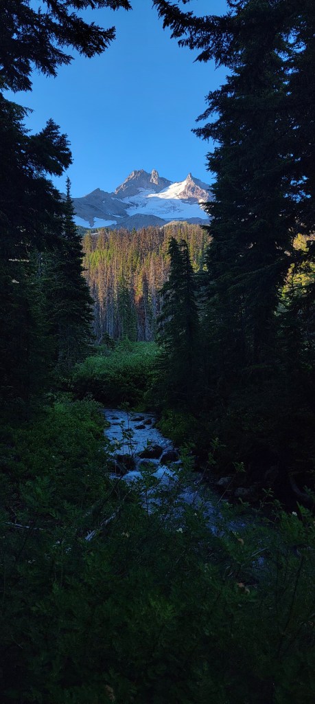
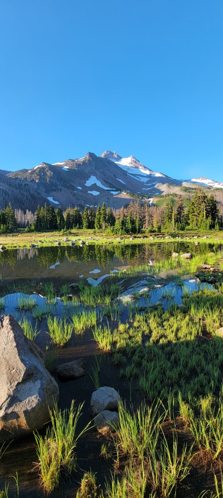
I woke this morning to the faint smell of smoke (I found out later that this was from a fire that had just broken out a couple of hours away). Part of me was mildly concerned, but part of me knew that most of the hike today would be through areas that have already burnt in the last few years. Sure enough, within a mile of camp, I’m back in a burn, tackling a grueling 2500ft climb with heavy legs. I pass through Jefferson Park, which is by far the most scenic area I’ve traversed this year. Lakes and streams are abundant, the trees are unburnt, and the views of Mt. Jefferson are spectacular.
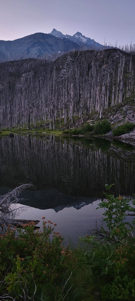
Most of the rest of the day is a descent to Olallie Lake. The first few miles are shady, but then, you guessed it, it went back into a burn. This time, it’s the Lionshead fire from a couple of years ago. The last 6 miles or so are almost completely burnt with only a few small clusters of live trees.


Omg, what photos!! And, I’m sure more striking in person!
LikeLike